Organic carbon
Understand organic carbon content and quantify the carbon stored in the soil.


Public sector · Digital soil maps
High-resolution maps that make the real variability of the soil visible.
Built on satellite data, field surveys and predictive models.
Digital soil intelligence
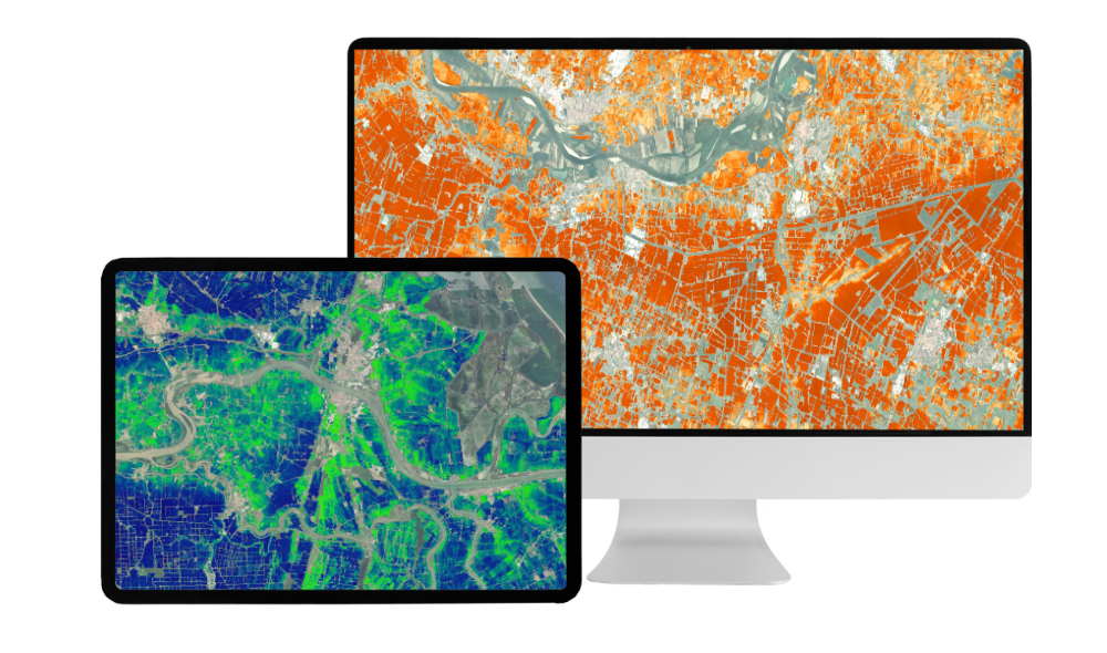
The Soil Mapping service transforms satellite data, field surveys and predictive models into high-resolution digital maps that reveal soil variability.
Using an advanced WebGIS platform, multi-year satellite imagery, AI and laboratory analyses are integrated to create an accurate, data-driven representation of soil characteristics.
Organic carbon, erosion risk and soil texture layers support evidence-based planning, sustainable land management and long-term monitoring of land resources.
Key indicators
High-resolution digital maps support the analysis of key soil characteristics.
Understand organic carbon content and quantify the carbon stored in the soil.
Identify erosion risk to inform land management and more sustainable practices.
Access detailed, real-time analysis of subsoil components.
The soil mapping process
An integrated digital process combines multiple data sources to map soil characteristics.
Each area of interest is digitised and georeferenced, creating the cartographic baseline that links every dataset to its real-world location.
Satellite imagery is processed with spatial analysis techniques to describe the surface and highlight differences within each field.
The surface is divided into homogeneous zones in terms of soil physico-chemical characteristics, the basis for rational sampling and intervention planning.
A targeted plan places collection points where they best represent soil variability, ensuring reliable data without redundancy.
Samples are collected with precision instruments and standardised procedures; each point is recorded with reliable geographic coordinates for full traceability.
Digital tools guide operators, record data in real time and support quality control, reducing manual errors and documenting the whole process.
Samples are analysed for texture, nitrogen, phosphorus and potassium, pH, electrical conductivity and cation exchange capacity.
Statistical techniques and machine learning integrate field data with environmental and satellite information, extending measurements to the whole area as continuous, high-resolution maps.
Final maps show texture, nutrient levels, pH, salinity and other indicators, compatible with GIS software and decision support systems.
Maps show the natural capacity of each area to support specific crops, helping select crops and varieties, design rotations and reduce agronomic risks.
Each model and map comes with quality indices and reliability metrics, so accuracy can be assessed and results used with confidence.
Georeferenced digital maps, quantitative indicators and structured reports, interoperable with GIS platforms and management software, including organic carbon, erosion risk and soil health.
Soil as a measurable asset
Soil erosion and organic carbon maps support land management, more efficient production and sustainable practices.
Accurate quantification of stored soil carbon can strengthen the position of countries and local businesses in the emerging carbon credit market, transforming soil into a measurable asset with economic value.
Product demo